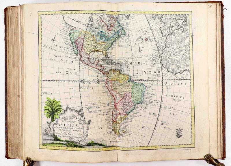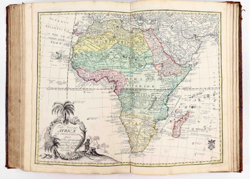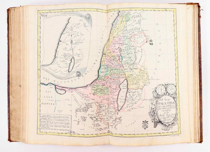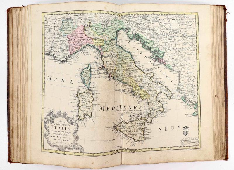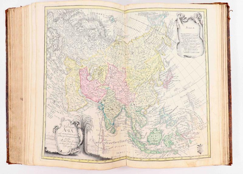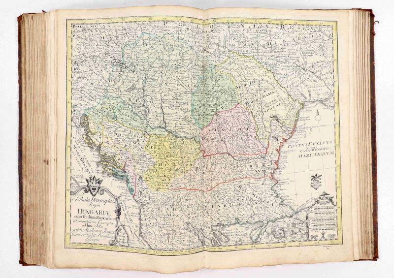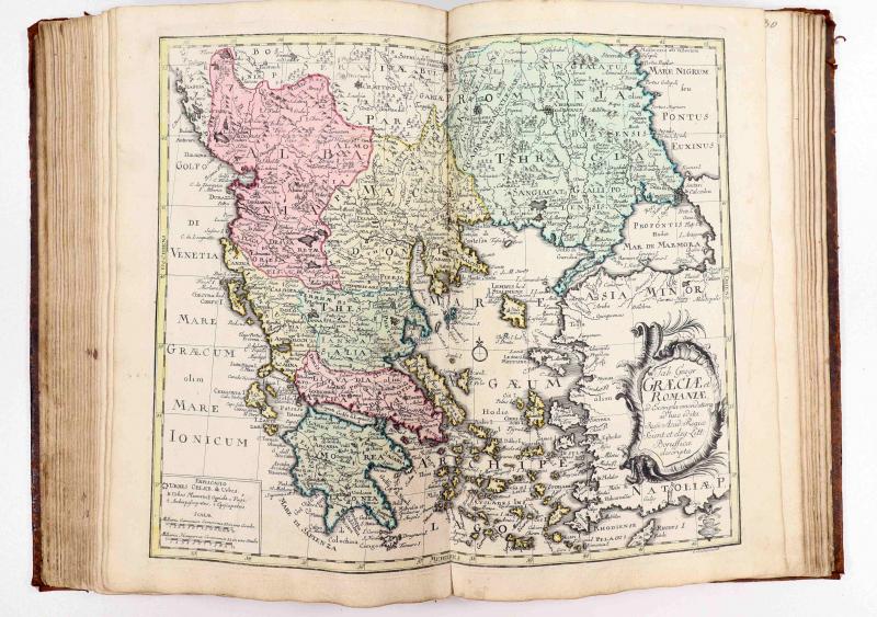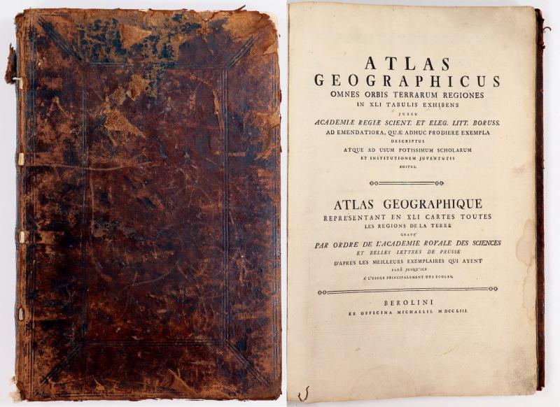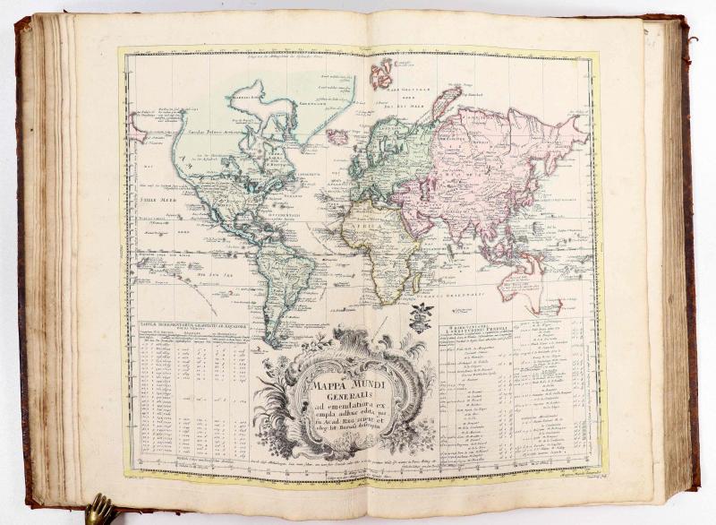
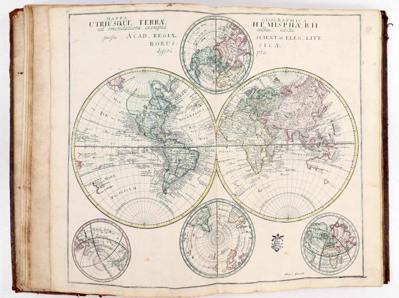
Atlas Geographicus Omnes Orbis Terrarum Regiones In XLI Tabulis Exhibens - Atlas Geographique Representant en XLI cartes toutes es regions de la terre. Beroloni [Berlin], ex Officina Michaelis 1753. 36 x 25 cm. XII S., [41] doppelblattgroße, altkolorierte Kupferstich-Karten. Zeitgenössisches Ganzleder mit Rückentitel. Einband stark berieben, am Rücken sowie an Ecken und Kanten mit Fehlstellen. Vorsätze stärker fleckig, mit Siegelresten [Umschlag] und handschriftlichen Besitzvermerken. Modernes Exlibris.
Phillips 3500. Seltene erste Ausgabe des berühmten ersten Atlas-Unternehmens der Königlich-Preußischen Akademie der Wissenschaften zu Berlin, von derem damaligen Leiter der mathematischen Klasse Leonhard Euler herausgegeben und mit einem zweispaltigen lateinisch-französischen Text versehen, der die 41 Landkarten und ihre Quellen kommentiert. Die Karten, größtenteils nach Vorlagen von Johann Christoph Rhode, wurden meist von Nicolaus Friedrich Sauerbrey gestochen, aber auch I.C.G. Claussen und J.E. Gericke waren beteiligt. Neun der Karten sind als Originalaufnahmen zu werten. Die übrigen sind Nachstiche nach engl. und Homannschen Karten. 5 Weltkarten (je eine als Projektion von Arktis bzw. Antarktis), 1 Pazifikkarte Mare Pacificum (hier hinter Nr. 5 gebunden), 4 Karten der Kontinente (Afrika, Asien, Amerika und Europa), 1 Karte von Europa auf 4 Doppelblättern, 1 Karte von Nordamerika auf 4 Doppelblättern,sowie Karten von Großbritannien, Russland, Türkisches Reich, Heiliges Land, Skandinavien, Dänemark, Griecheland, Italien, Spanien, Frankreich, Deutschland, Polen, Ostpreussen u.a. Die handschriftliche Num. teils falsch und irreführend. Jede Karte ist original altkoloriert und trägt den Stempel der Akademie der Wissenschaften! Mit handschriftlichen Besitzvermerken J.W. De Pavinowitz und C. Gielen Cure a Stevensweert 1817. Vollständig und selten. First edition of the Atlas by the famous mathematician Leonhard Euler. The Atlas was published on behalf of the Royal Prussian Academy of Sciences in Berlin by Leonhard Euler, designed specifically for the use in schools. The maps were largely based on works of Johann Christoph Rhode and were mostly engraved by Nicolaus Friedrich Sauerbrey. Each map has a stamp of the Royal Prussian Academy of Sciences.
7500,- EUR
Differenzbesteuert/Subject to margin taxation
Sachgebiete: Atlanten
Kontakt zum
Preister Straße 26 • 54662 Speicher
Telefon: +49 151 58505622
Mail: Antiquariat.Fritzen@t-online.de • Web: https://www.antiquariat-fritzen.com

On the Eastern border of the former Duchy of Luxembourg, in the former bakery of my parents’ house, I offer you a wide range of historical maps and rare books, with a special focus on graphic material relating to Luxembiurg and Trier. I also specialize in rare and precious books from the 15th to the 18th century. Do not hesitate to contact me if you need help or advice in building up your own, personal collection, or if you think of further developing an already existing one. I can also advise you if you are looking for a small present, or if you are in search of a more representative gift. I am always interested in buying entire libraries or valuable items.
I was born in 1958 in Speicher (Eifel). I studied art history at Trier and at Vienna, and established myself as an independent antiquarian bookseller in 1987. I am a member of the Verband Deutscher Antiquare (VDA) and of the International League of Antiquarian Booksellers (ILAB) Besides being a book-seller, I have also authored of a number of scholarly publications, mainly dealing with book and map history. I am regularly called upon by German and Luxembourgisch archives, libraries, and museums to act as conultant, appraiser, or estimator. The following is a representative choice of my papers: (i) ‘Der “Lutzenburgii typus” des Antwerpener Verlages Gerard de Jode. Ein Neufund und neue Erkenntnisse zur ältesten gedruckten Landkarte des Herzogtums Luxemburg’, in: Hémecht 60 (2008), pp. 173 – 190 (in collab. with Peter H. Meurer). (ii) ‘Die Eifel-Alben der Kunstanstalten Bernhoeft und Schaar & Dathe. Ein Wettlauf um das schönste Foto-Album der Eifel’, in: Eifeljahrbuch 2010, pp. 156 – (iii) ‘Charles Bernhoeft et ses concurrents de Trèves’, in: Edmond Thill (ed.), Charles Bernhoeft, photographe de la Belle Epoque, Luxembourg: Musée National d’Histoire et d’Art Luxembourg, 2014, pp. 413 – 441; ibid.: ‘Catalogue des albums de Charles Bernhoeft’, pp. 621 – 721 (in collab. with Fernand Gonderinger and Edmond Thill). (iv) ‘Die Ortelius-Karte von Luxemburg und ihre Zustände’, in: Hémecht 69 (2017), pp. 149 – 160 S 149-160 (in collab. with Karl Solchenbach). I feel especially committed to helping the regional libraries to develop their collections and take professional care of them. In my capacity as vice chairman of the Gesellschaft der Freunde und Förderer, I devote a great deal of time and energy to the Wissenschaftliche Bibliothek der Stadt Trier, which houses a very important and internationally renowned collection of manuscripts and incunabula.
Download at we-transfer https://we.tl/t-vzi7UwU3y5yakbUO