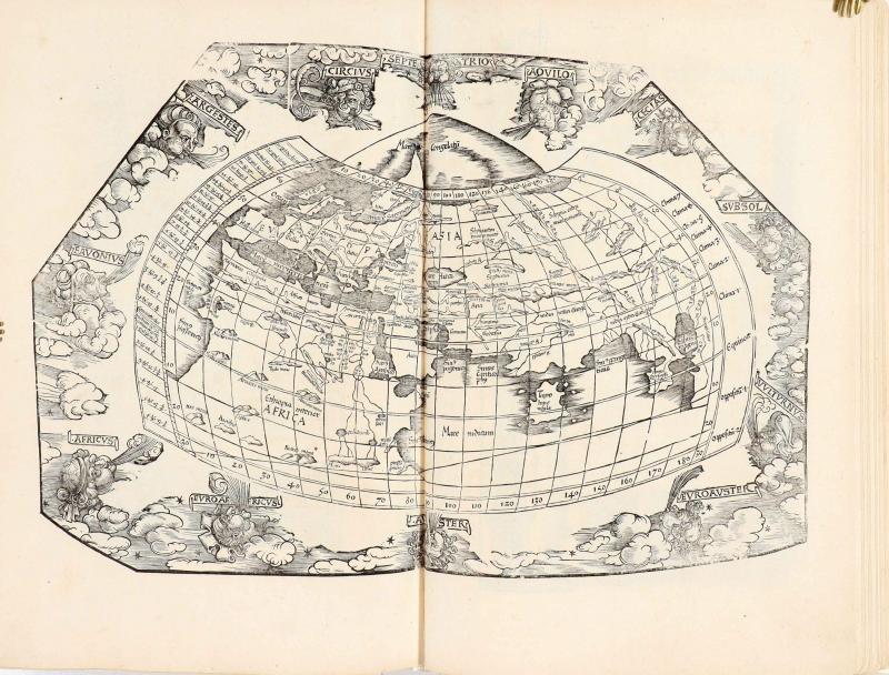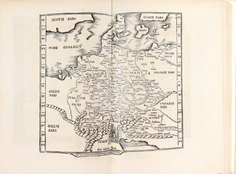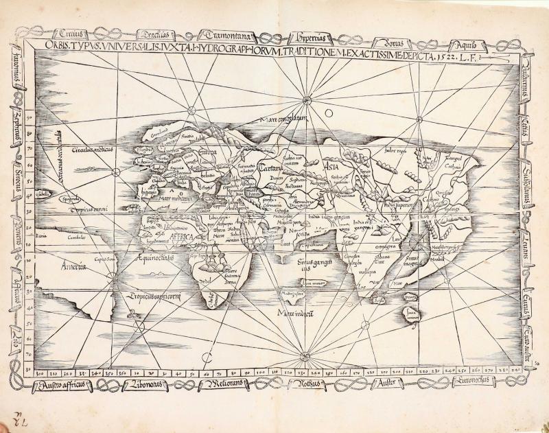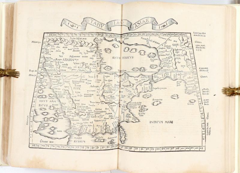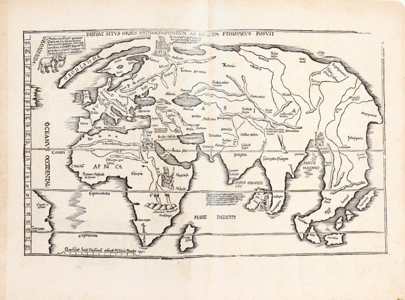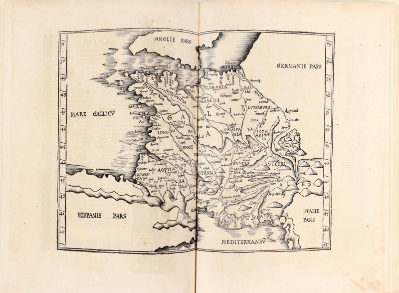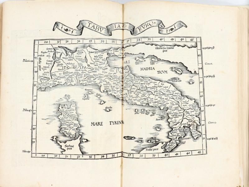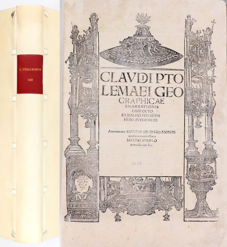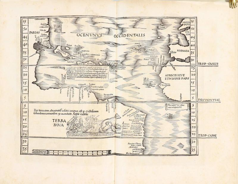
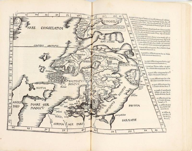
Ptolemaeus, Claudius, Geographicae enarrationis libri octo B. Pirckeymhero interprete. Annotationes I. de Regio Monte inerrores commissos a J. Angelo in translatione sua. Straßburg, Johann Grüninger 1525. 40,5 x 28 cm. 82, [14], [34] Bl. Mit breiter Holzschnitt-Titelbordüre, 50 (49 doppelblattgr.) Holzschnittkarten und zahlreichen Textholzschnitten und -initialen. Moderrnes Ganzpergament mit Lederbändchen. Behutsam restauriert, Blätter an den Ecken leicht abgerundet. Modernes Exlibris.
Phillips/Le Gear 362. Sabin 66481. Harisse 136. Carter Brown Libr. I, 95. Nordenskiöld 208. VD16 P 5211. Schmidt, Grüninger 222. Erste Ausgabe mit der lateinischen Übersetzung von Willibald Pirckheimer und zweite Grüninger-Ausgabe. Prachtvolle und reich ausgestattete Ausgabe des ptolemäischen Weltatlas mit einer der frühesten Karten der Neuen Welt. Enthält 27 ptolemäische und 23 "moderne" Karten, sämtliche von den Stöcken der Ausgabe von 1522 mit Ausnahme der in passendem kleinerem Format neu geschnittenen Quinta Asiae Tabula. Vorhanden sind 3 Weltkarten, darunter die bekannte, 1522 von L. Fries hrsg. Weltkarte (Shirley 48) von Waldseemüller mit dessen erstmalig verwendeter Bezeichnung America, sowie 23 Karten von Europa, 6 von Afrika, 17 von Asien und 1 von Amerika (umseit. mit Bericht von Columbus' Reise). Die Tabulae modernae mit Karten von England mit Schottland und Irland, Spanien, Frankreich, Deutschland, Polen, Ungarn, Belgien, Italien, Korsika und Sardinien, Bosnien und Griechland, Griechenland, Afrika, Libyen, Südafrika, Asien, Heil.Land, Indien, Tibet, Indien, Schweiz, Mitteldeutschland, Lothringen, Kreta und den Weltkarten. Unter den Textholzschnitten die für diese Ausgabe geschaffene blattgr. Darstellung einer Armillarsphäre von A. Dürer (Bl. 69 verso; Meder 262). Die Textseiten zu Beginn und auf der Rückseite der Karten meist mit prächtigen ornamentalen Bordüren geschmückt, die der Baseler Schule um Holbein zugeschrieben werden. First edition of Pirckheimer's translation and second ed. printed by Grüninger. 50 woodcut maps (49 doublepage, 1 fullpage; including the world map by Fries from 1522 mentioning America) and numerous woodcuts in the text (incl. 1 fullpage woodcut by A. Dürer, showing an armillary sphere). Modern vellum.
80000,- EUR
Differenzbesteuert/Subject to margin taxation
Sachgebiete: Amerika, Antike, Atlanten
Kontakt zum
Preister Straße 26 • 54662 Speicher
Telefon: +49 151 58505622
Mail: Antiquariat.Fritzen@t-online.de • Web: https://www.antiquariat-fritzen.com

On the Eastern border of the former Duchy of Luxembourg, in the former bakery of my parents’ house, I offer you a wide range of historical maps and rare books, with a special focus on graphic material relating to Luxembiurg and Trier. I also specialize in rare and precious books from the 15th to the 18th century. Do not hesitate to contact me if you need help or advice in building up your own, personal collection, or if you think of further developing an already existing one. I can also advise you if you are looking for a small present, or if you are in search of a more representative gift. I am always interested in buying entire libraries or valuable items.
I was born in 1958 in Speicher (Eifel). I studied art history at Trier and at Vienna, and established myself as an independent antiquarian bookseller in 1987. I am a member of the Verband Deutscher Antiquare (VDA) and of the International League of Antiquarian Booksellers (ILAB) Besides being a book-seller, I have also authored of a number of scholarly publications, mainly dealing with book and map history. I am regularly called upon by German and Luxembourgisch archives, libraries, and museums to act as conultant, appraiser, or estimator. The following is a representative choice of my papers: (i) ‘Der “Lutzenburgii typus” des Antwerpener Verlages Gerard de Jode. Ein Neufund und neue Erkenntnisse zur ältesten gedruckten Landkarte des Herzogtums Luxemburg’, in: Hémecht 60 (2008), pp. 173 – 190 (in collab. with Peter H. Meurer). (ii) ‘Die Eifel-Alben der Kunstanstalten Bernhoeft und Schaar & Dathe. Ein Wettlauf um das schönste Foto-Album der Eifel’, in: Eifeljahrbuch 2010, pp. 156 – (iii) ‘Charles Bernhoeft et ses concurrents de Trèves’, in: Edmond Thill (ed.), Charles Bernhoeft, photographe de la Belle Epoque, Luxembourg: Musée National d’Histoire et d’Art Luxembourg, 2014, pp. 413 – 441; ibid.: ‘Catalogue des albums de Charles Bernhoeft’, pp. 621 – 721 (in collab. with Fernand Gonderinger and Edmond Thill). (iv) ‘Die Ortelius-Karte von Luxemburg und ihre Zustände’, in: Hémecht 69 (2017), pp. 149 – 160 S 149-160 (in collab. with Karl Solchenbach). I feel especially committed to helping the regional libraries to develop their collections and take professional care of them. In my capacity as vice chairman of the Gesellschaft der Freunde und Förderer, I devote a great deal of time and energy to the Wissenschaftliche Bibliothek der Stadt Trier, which houses a very important and internationally renowned collection of manuscripts and incunabula.
Download at we-transfer https://we.tl/t-vzi7UwU3y5yakbUO