Ortelius, Abraham
1571, Antwerp, Gielis Coppens van Diest
Theatrum Orbis Terrarum. Complete copy, bound in a contemporary vellum binding, (8) 53 maps (29) Folio.
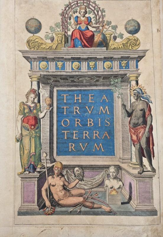
Engraved architectural title with the figure of Europe at the top. With 53 contemporary hand-coloured double-page engraved maps.
H. 43 x W. 30 cm. / H. 16.90 x W. 11.8 inch.
Rare early edition of Ortelius’ revolutionary atlas, first published in Antwerp in 1570 (also a Latin edition). Ortelius’ atlas was revolutionary because it was the first attempt to present the geography of the world in a uniformly produced collection of maps of all known parts of the world. Ortelius designed the maps himself, basing his designs on the cartographic sources that he had at hand (and, equally revolutionary, also mentioning his sources on the maps), and once finished, had them engraved by Frans Hogenberg and Ambrosius and Ferdinand Aertsen. Finally, Gielis Coppens van Diest printed the maps, after which they could be coloured (also in a uniform style) and bound in a logical order in one volume. These atlases were a new phenomenon and proved to be very popular in Europe. Soon, editions were published in various languages of Europe in print runs of a few hundred copies each. Few maps are slightly (finger-)stained in the wide margins. Contemporary vellum binding with some scratches and stains.
Overall, a remarkable copy of this famous atlas in beautiful contemporary colours. Van den Broecke estimates that of this 2nd Latin edition, approximately 275 copies were printed.
Literature: Van de Krogt/ Koeman IIIA, 31:002; Adams O-335; Phillips 382; Shirley 122 (with the world map in his first plate, first state).
Sachgebiete: Amerika, Atlanten, Kartographie, Landkarten, Schifffahrt
31.07.2026 - 10:36
75000,- EUR
Antiquariaat De Roo

, Selbstporträt, 1946_02.jpg)